Homeless encampments & 311 reports in Fremont, Seattle
Fremont is one of Seattle's 53 Community Reporting Areas, with about 18,742 residents across 1.4 sq mi.
Fremont has 108 currently-open homeless encampment reports filed with Seattle's 311 system — the #29 highest of Seattle's 53 neighborhoods. 2.7% of Fremont's blocks have at least one active encampment report — below the 4.1% citywide average.
How Fremont compares
Open encampment reports · % of blocks affected, ranked against other Seattle neighborhoods.
Open homeless encampment reports
Every currently-open Unauthorized Encampment report in Fremont. Click a tent to see the address and date filed.
Example cleanups in Fremont
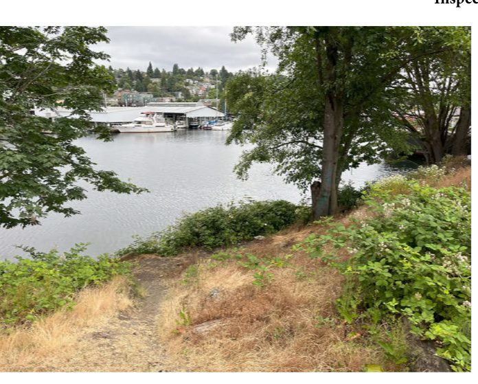
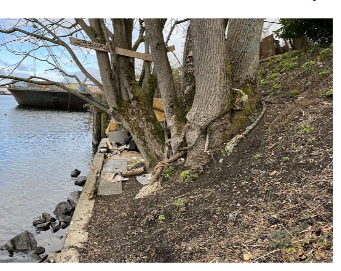
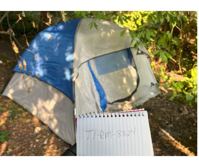
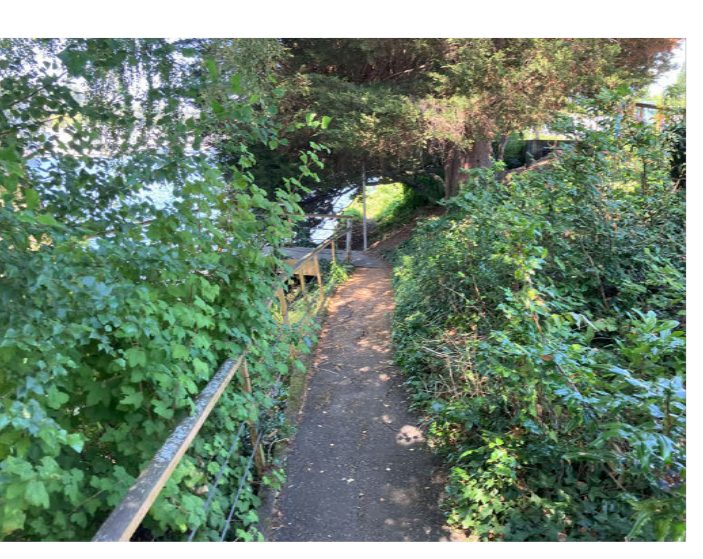
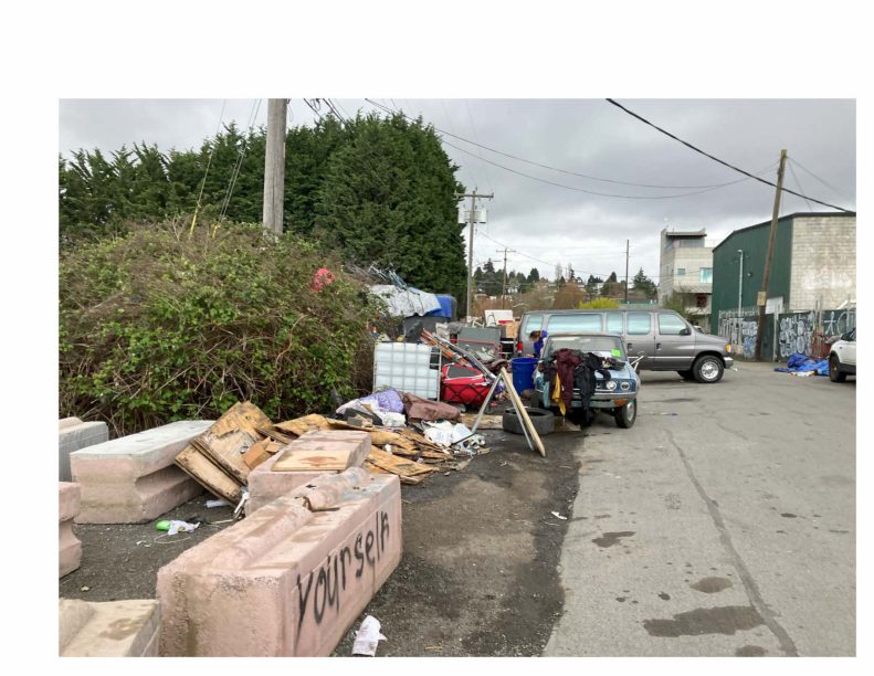
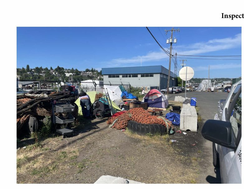
Click any photo to open the City of Seattle site journal PDF it was extracted from.
Look up a specific address in Fremont
The numbers above are aggregated across all of Fremont. To see what's reported on a specific block — including the nearest active encampments to a given address — search by address:
Search an address →Frequently asked questions about homelessness in Fremont
How many homeless encampments are reported in Fremont?
Fremont has 108 currently-open homeless encampment reports filed via Seattle's 311 / Find It Fix It system. In the last 365 days, residents have filed 1269 encampment reports for the area.
What share of Fremont blocks have active homeless encampment reports?
2.7% of Fremont's 710 blocks currently have at least one active homeless encampment report. The Seattle citywide average is 4.1%.
Where are homeless encampments in Fremont concentrated?
The interactive map above plots every currently-open homeless encampment report in Fremont. Reports cluster along arterial corridors, parks, and freeway underpasses — click any tent marker to see the exact address and date filed.
How does Fremont compare to other Seattle neighborhoods?
Fremont ranks #29 out of 53 Seattle neighborhoods for the share of blocks with active homeless encampment reports. The most-affected neighborhood is Pioneer Square/International District (21.9%); the least-affected is Wedgwood/View Ridge (0.0%).
Where can I see official Seattle homeless encampment cleanup records?
The City of Seattle's Encampment Response Team publishes site journals (PDFs) after every cleanup. Each cleanup photo on this page links to the source journal from seattle.gov.
Nearby neighborhoods
Methodology
Data comes from Seattle's Customer Service Request system (Find It Fix It / 311). Each report is geocoded by the City to a Community Reporting Area; we aggregate by CRA(s) that match the named neighborhood. The "last 90 days" window is anchored to the most recent report date in the dataset. Photos are extracted from the City of Seattle's published Encampment Response Team site journals.